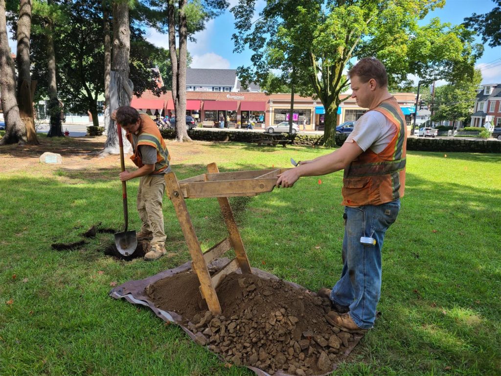
In preparation for digging of wells for an upcoming geothermal heating and cooling system in the Jason Russell House, the Arlington Historical Societyhas contracted to have Archaeological fieldwork done on the affected portion of the grounds. The Public Archaeology Laboratory of Pawtucket, RI has been hired to conduct a one day excavation of an area northwest of the house.They will excavate by hand a series of test pits at 4-meter intervals within the proposed project area. Any cultural materials will be bagged and tagged by level within each pit.

The proposed geothermal project was funded by Community Preservation Act funds and will help to improve climate inside the historic home with minimal invasiveness to historic fabric and at minimal ongoing cost. The house is currently not heated or cooled, and this will help to protect the material of the house itself as well as the objects within and also make it more comfortable for visiting public during summer and winter. The geothermal project will require the digging of a three- to four-foot-deep, 40-foot-long trench running northeast from the house’s northeast corner to a 40 by 20-foot drilling area. Three to five wells will be installed in the drilling area to a depth of 250 to 300 feet. There will be no aboveground structures associated with geothermal installation in keeping with property’s preservation restriction and restrictions associated with its status as a contributing building to several historic districts in Arlington.
The purpose of the Archaeological Survey is to identify any potentially significant archaeological resources that may be affected by the project. Work is being conducted under a State Archaeologist’s permit issued by the MHC. This will only be the second archaeological dig on the site, the last one taking place in 1985. The 1985 project was led by Mark Boulding of Boston University, and was part of Arlington’s 350th anniversary celebrations. This limited study involved a series of test pits outside the front door and under the floorboards of the kitchen, with a goal to learn more about the date of construction of the house. Unfortunately, both locations exposed heavily disturbed soils containing a mix of 19th and 20th century materials with an unclear stratigraphy (that is, the orderly layers of archaeological remains), none of which provided clear indications of the house construction date. To read more about this project, visit our blog https://arlingtonhistorical.org/archaeology-at-the-jason-russell-house/
The Jason Russell House grounds have been quite disturbed over the years as the land around the farmhouse evolved into the residential and commercial area we now know as Arlington Center. Portions of the property were sold off by descendants so that by the late-nineteenth century very little of the grounds that we know today survived. Several new homes were constructed around and in front of the house between 1884 and 1908. The Historical Society purchased the house in 1923 and purchased and removed four surrounding buildings in the 1960s to provide a more period appropriate setting for the house and to make it visible from the intersection of Jason Street and Massachusetts Avenue.

Based on land-use history, we anticipate that the archaeological resources will consist primarily of debris associated with the construction of these later buildings. There is low potential for the survival of intact cultural features associated with the use of the property by the Russell family. The project area, however, encompasses two anomalies identified in the recent ground penetrating radar study conducted by Geophysical Survey Systems, Inc. (GSSI). One anomaly is likely a septic tank cap and another is a round shaft that could be a well or privy. GSSI’s analysis determined that there is potential archaeological integrity to the project area, despite such drastic changes to the land in the late 19th through mid-20th centuries. Because of this, all future ground-disturbing activities at the Jason Russell house will incorporate professional archaeological testing of impacted areas.
What we know about the Jason Russell House is constantly evolving based on ongoing expertise and analysis. In 2012 the Society hired a dendrochronology firm to conduct tree ring dating of cores inside the house, which determined that the house was not built in two stages starting in the late 1600s as was previously believed. The house was likely built in a single campaign in the 1740s using materials salvaged from an earlier 17th century structure – likely a home he inherited from his grandparents. See https://arlingtonhistorical.org/what-do-we-know-about-the-construction-of-the-jason-russell-house/ for more information.
More recently (2020-2021) multiple visits from a team of experts to research and study the battle damage in the House and in objects in our collection. Surprisingly, four unknown bullet strikes were rediscovered along with some interesting clues about all existing strikes. Spring 2021 a laser scan of the interior and exterior of the structure was conducted, and ground penetrating radar of the grounds in late summer 2021. It appears that the house may not have been moved, as we formerly understood, which makes archaeological investigation all the more important. For more information on this project see our Winter 2021 and Winter 2020 newsletters linked at https://arlingtonhistorical.org/learn/newsletter/
